
|
DOCUMENTATION_FORMAT: Man_Made
SAMPLE_ID: oiled sand at site DWO-06b
MATERIAL_TYPE: beach sand and weathered oil
MATERIAL: Weathered oil from the Deepwater Horizon spill
FORMULA:
FORMULA_HTML:
COLLECTION_LOCALITY: Grand Isle, Louisiana
COLLECTION_LATITUDE: 29.24648 deg. N
COLLECTION_LONGITUDE: 89.96600 deg. W
DATUM: WGS-84
ORIGINAL_DONOR: Raymond F. Kokaly, USGS
CURRENT_SAMPLE_LOCATION: USGS, Denver
ULTIMATE_SAMPLE_LOCATION:
SAMPLE_DESCRIPTION:
Average of spectra of an area of beach sand saturated with weathered oil from the Deepwater Horizon spill measured on the beach on Grand Isle, Louisiana. Spectrum measured in the field on June 9, 2010. The reflectance spectrum has strong absorption features centered near 1.72 and 2.30 microns arising from C-H bonds in weathered oil.
Spectrum was used in:
Kokaly, R.F., Couvillion, B.R., Holloway, J.M., Roberts, D.A., Ustin, S.L., Peterson, S.H., Khanna, S., and Piazza, S.C., 2013,
Spectroscopic remote sensing of the distribution and persistence of oil from the Deepwater Horizon spill in Barataria Bay marshes,
Remote Sensing of Environment, Volume 129, Pages 210-230. http://dx.doi.org/10.1016/j.rse.2012.10.028
IMAGE_OF_SAMPLE: 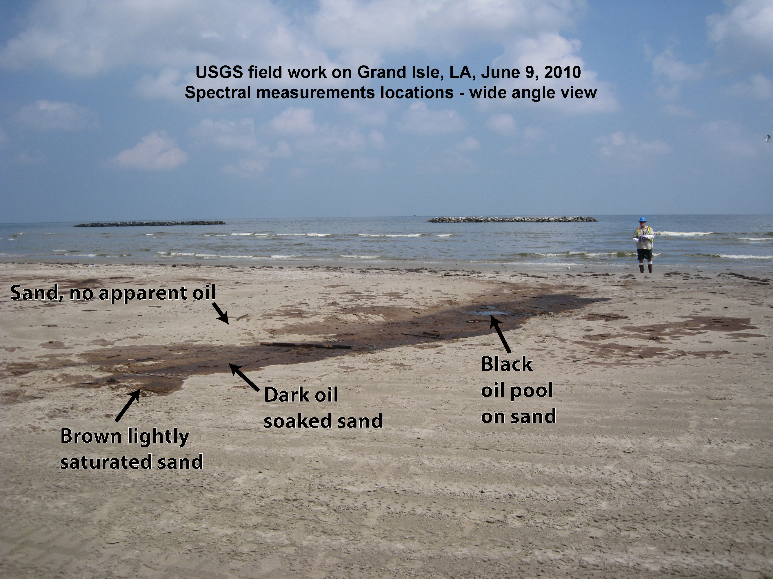
END_SAMPLE_DESCRIPTION.
XRD_ANALYSIS:
None
END_XRD_ANALYSIS.
COMPOSITIONAL_ANALYSIS_TYPE: None
COMPOSITION_TRACE: None
COMPOSITION_DISCUSSION:
No additional compositional details available.
END_COMPOSITION_DISCUSSION.
MICROSCOPIC_EXAMINATION:
END_MICROSCOPIC_EXAMINATION.
SPECTROSCOPIC_DISCUSSION:
END_SPECTROSCOPIC_DISCUSSION.
SPECTRAL_PURITY: 1a2_3_4_ # 1= 0.2-3, 2= 1.5-6, 3= 6-25, 4= 20-150 microns