
|
DOCUMENTATION_FORMAT: MIXTURE
SAMPLE_ID: WRF00-01
MIXTURE_TYPE: Intimate
MIXTURE: all components of post-fire surface for a burned Ponderosa Pine forest
FORMULA: Not Available
FORMULA_HTML: Not Available
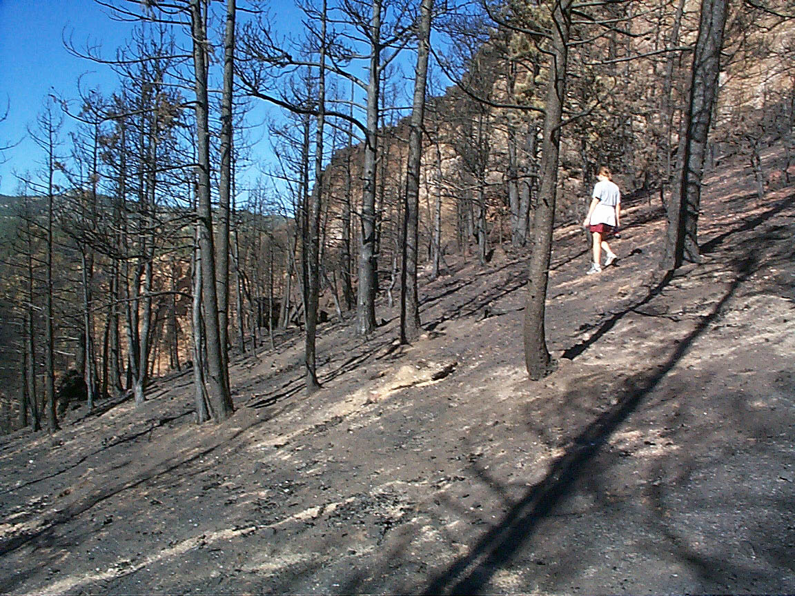
COLLECTION_LOCALITY: Walker Ranch Fire, Boulder, Colorado USA
ORIGINAL_DONOR: Raymond Kokaly
COLLECTION_LATITUDE: Not Available
COLLECTION_LONGITUDE: Not Available
DATUM: # coordinate datum
CURRENT_SAMPLE_LOCATION: Not a sample
ULTIMATE_SAMPLE_LOCATION: Not a sample
SAMPLE_DESCRIPTION:
This is not a spectrum of a collected sample but it is an average of 27 field spectra collected of a severely burned area (including the white ash and blackened ash/char material, and exposed soil minerals) following a wildfire in a ponderosa pine forest. The Walker Ranch Fire (also called the Eldorado Fire at Walker Ranch) occurred on September 15, 2000, in an area west of Boulder, Colorado. The field spectra were collected on September 28, 2000. The fiber optic head of the spectrometer was held approximately 3 feet above the surface of the charred soil. Each of the 27 recorded spectra were 6 second averages of 60 individual spectra measured by the field spectrometer while the user was walking slowly around the burned area. During the measurement, the area covered was roughly a 20 meter by 20 meter area. The average of the 27 field spectra was computed then corrected to absolute reflectance using a National Institute of Standards spectralon correction. Atmospheric absorptions regions were deleted from the final spectrum (data points near 1.4, 1.9, and 2.05 microns and greater than 2.45 microns were modified in this way to remove all traces of atmospheric residues in the field spectra).
Spectrum published in:
Kokaly, R.F., Rockwell, B.W., Haire, S.L., and King, T.V.V., 2007,
Characterization of post-fire surface cover, soils, and burn severity at the Cerro Grande Fire, New Mexico, using hyperspectral and multispectral remote sensing,
Remote Sensing of Environment, Volume 106, Issue 3, Pages 305-325. http://dx.doi.org/10.1016/j.rse.2006.08.006
Photos:
END_SAMPLE_DESCRIPTION.
XRD_ANALYSIS:
None
END_XRD_ANALYSIS.
COMPOSITIONAL_ANALYSIS_TYPE: XRF # XRF, EPMA, ICP(Trace), WChem
COMPOSITION_TRACE: None
COMPOSITION_DISCUSSION:
None
END_COMPOSITION_DISCUSSION.
MICROSCOPIC_EXAMINATION:
None
END_MICROSCOPIC_EXAMINATION.
SPECTROSCOPIC_DISCUSSION:
END_SPECTROSCOPIC_DISCUSSION.
SPECTRAL_PURITY: 1b2_3_4_ # 1= 0.2-3, 2= 1.5-6, 3= 6-25, 4= 20-150 microns